One live geospatial canvas for planning uncrewed missions, routes, waypoints, areas of interest, and keep-out zones, rehearsed against real terrain before anything leaves the ground.
Every mission starts with the map.
Uncrewed operations live or die on planning. VANTAGE puts the whole picture, imagery, terrain, airspace, and assets, on one canvas, so operators can go from intent to executable mission in minutes, not hours.
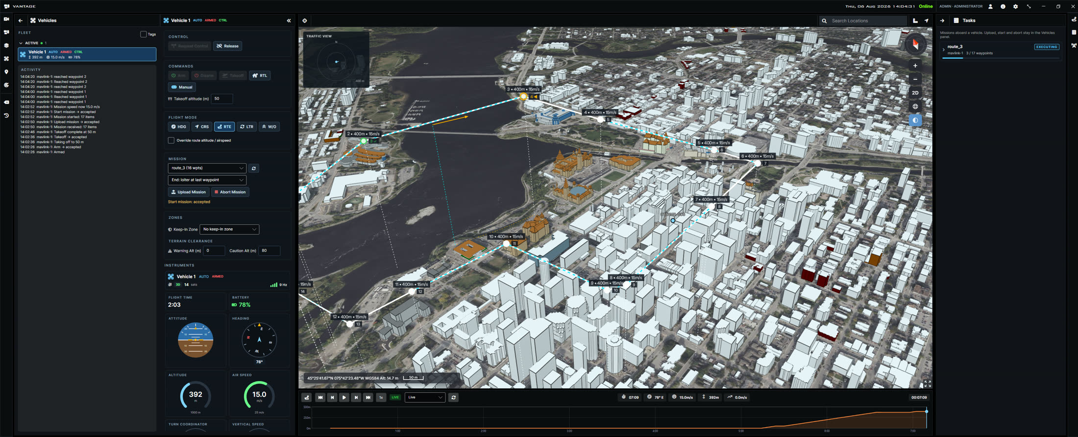
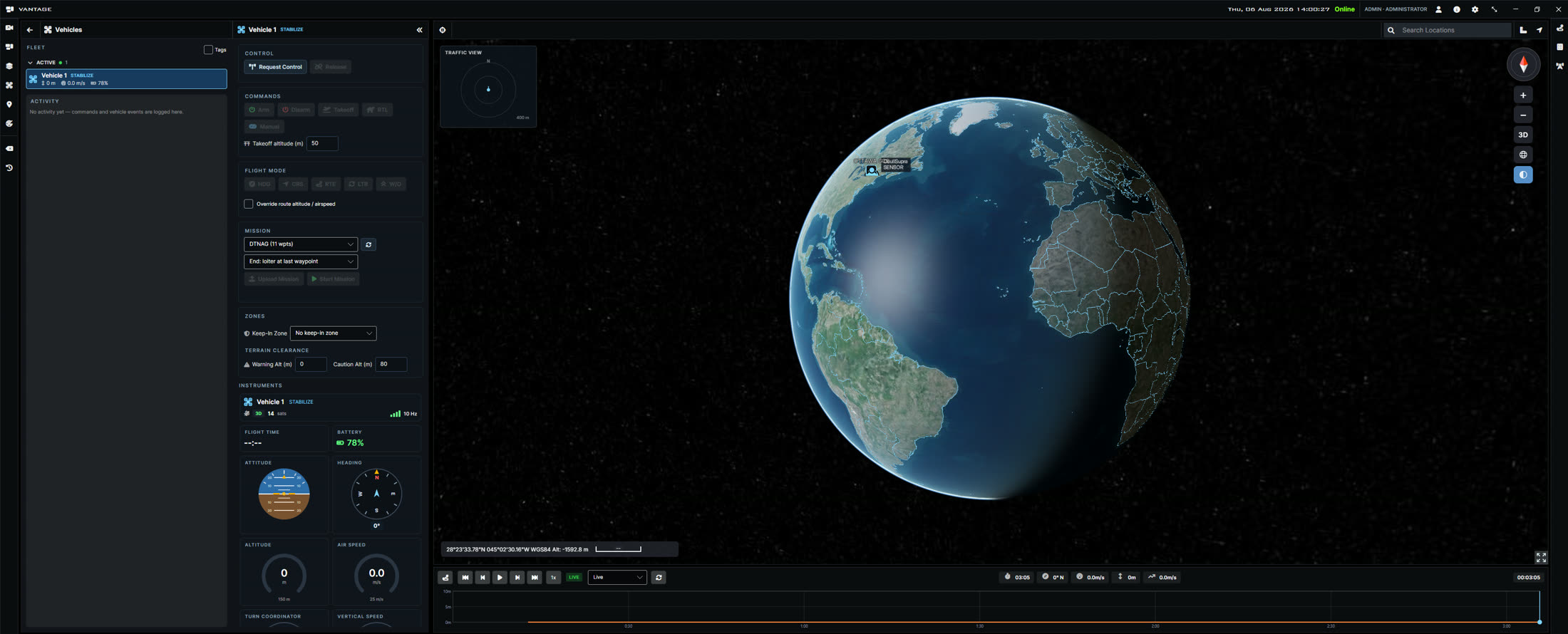
Fuse imagery, tracks, and intelligence into one live, georeferenced picture. Move from a global view to street level in seconds, with full 2D, 3D, and terrain context.
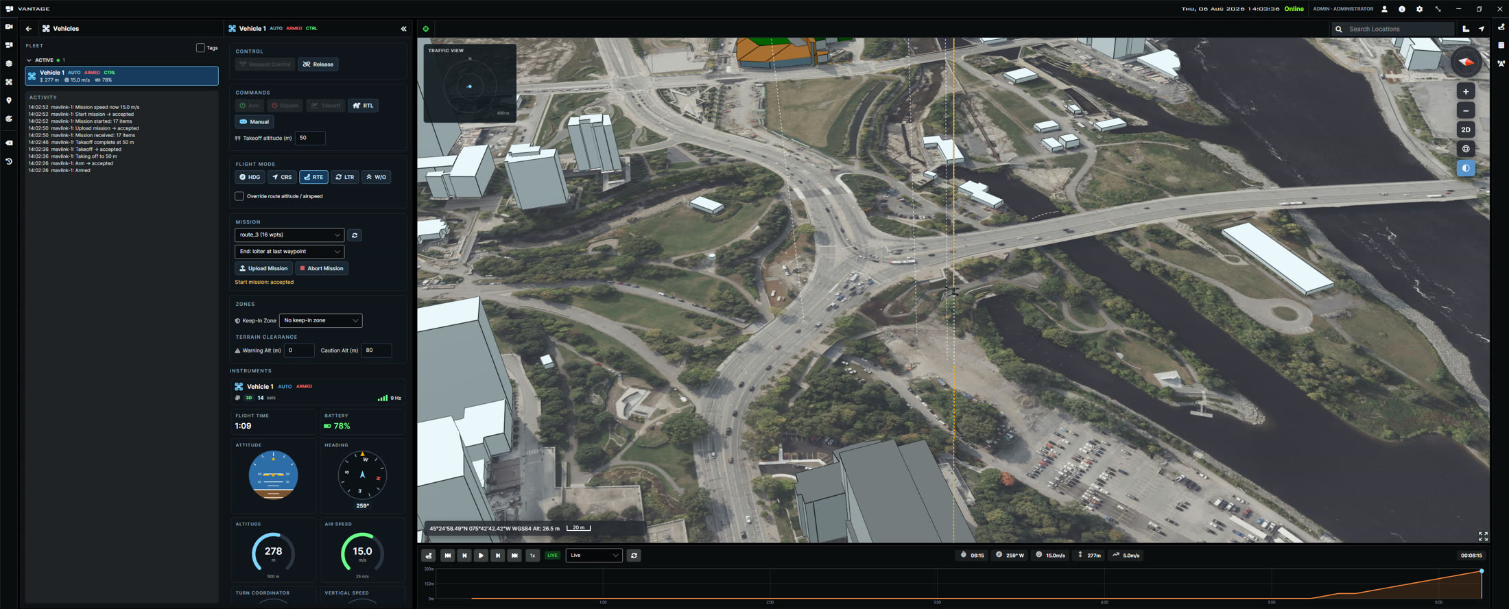
Lay out routes, waypoints, and areas of interest for uncrewed platforms in any domain. Build the plan against terrain and airspace, rehearse it, then push it to operators and platforms.
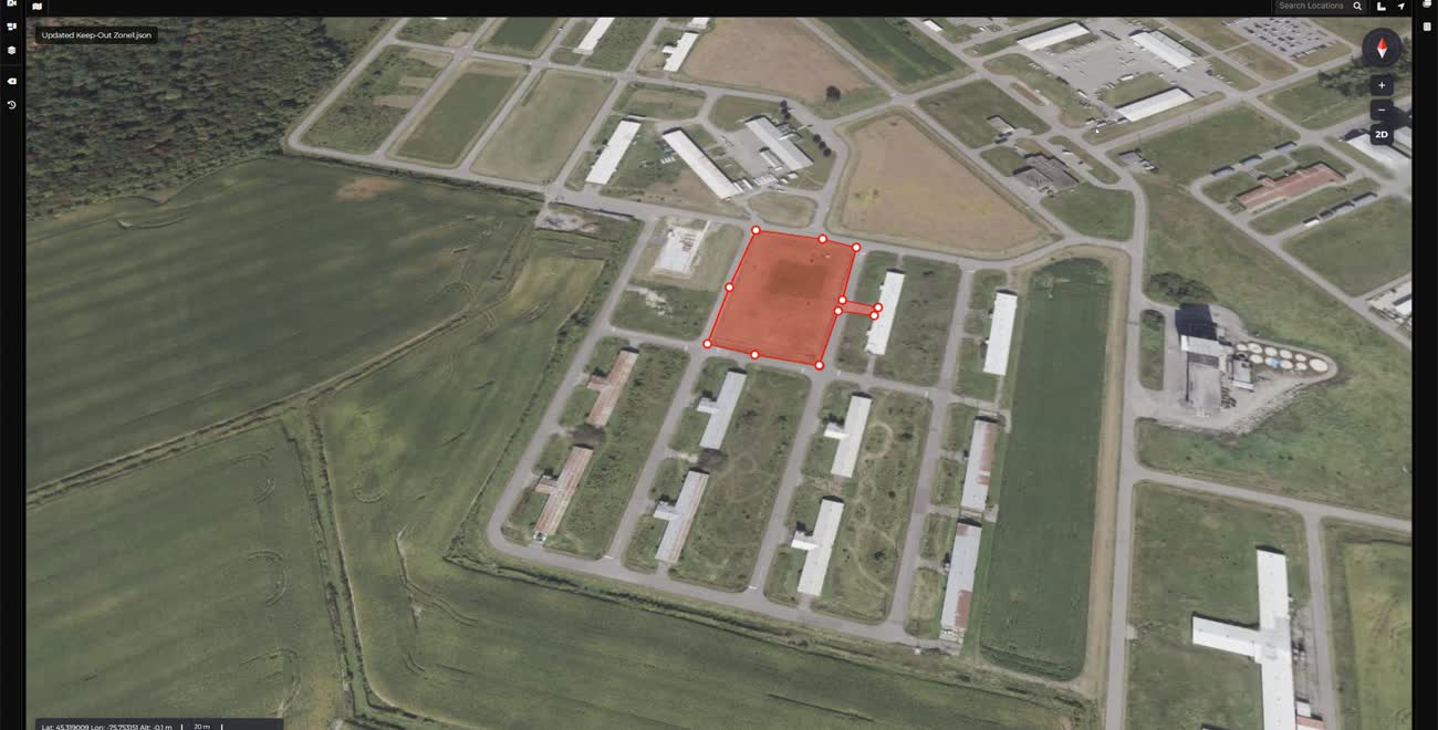
Define geofences and keep-out volumes with point-and-click precision, then enforce them across every asset in the plan. Deconflict shared airspace before launch and during the mission.
VANTAGE speaks the standards your platforms already use, commanding uncrewed aircraft over STANAG 4586 and ground vehicles over JAUS (AS5684), with live telemetry, video, and obstacle awareness in the same picture.
Mission execution isn’t a separate tool. Upload the route to a ground vehicle over JAUS, watch it execute waypoint by waypoint, and keep the vehicle’s own camera beside the map, with obstacles flagged the moment the platform reports them.
A tour through VANTAGE: global situational view, zoom to the operating area, route construction, and keep-out zone management, all in one session.
The same planning workflow adapts to whatever you fly, drive, sail, or task, so teams stop juggling one tool per platform.
Sortie and corridor planning for UAS, from quadcopters to fixed-wing, with altitude, airspace, and endurance in view.
Route planning for UGVs across real terrain, slopes, obstacles, and mobility constraints considered up front.
Track planning for surface and subsurface vehicles, with coastlines, channels, and exclusion areas built in.
Plan collection windows and coverage for satellite tasking alongside the missions they support.
VANTAGE is the planning layer of the Phoenix stack, pair it with our sensing and edge AI products to close the loop.
We’ll walk your team through VANTAGE live, on scenarios that match your operating environment.